|
|
The South
Asian Life & Times - SALT |
|
|||
|
Contents Adventure
Art
-
Dongria Kondh
|
|
||||
|
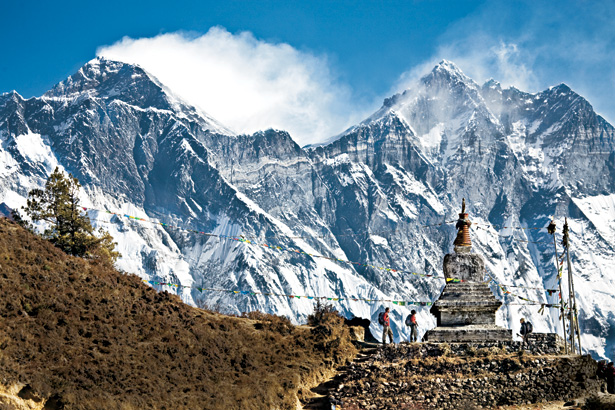
The Great Himalaya Trail
The Great Himalaya Trail (GHT) in Nepal winds
through one of the world's most dramatic mountain regions, wherein lie many
of the rugged, ice-clad fourteen 8,000m peaks, iridescent blue lakes,
surreal valleys, arid plateaus, and highland villages frozen in time where
life remains as it was centuries ago, inhabited by some of the most remote
communities on earth, some still practicing polyandry. Stretching the entire 1700 km length of the Himalaya
in Nepal, from Kangchenjunga in the east to Humla / Darchula in the west,
the main trek of the Great Himalayan Trail is a network of established
trails linked with new and recently developed ones, far-removed from the hub
of oft-trodden commercial treks. Some of the treks cross high Himalayan
passes with unparalleled view of surrounding mountain landscapes, where
there are no teahouses, no human habitation for miles, and no marked trail. The ten treks that constitute the GHT are strewn
along its upper and lower routes, each trek offering a novel thrill and
experience, of varying duration and difficulty, some require camping
equipment while others can be done teahouse style. The upper and lower
routes are not well-defined, continuous, or demarcated routes. In fact, at
many places one can switch from one to another and follow the path of the
heart. The upper trail, at an average altitude of 3000 to
5000 metres, is the high mountain route possessed with adventure and sense
of exploration. It stretches over a distance of about 1,700 km and passes
through spectacular, high altitude mountain landscapes, crossing high passes
with altitudes up to 6,200m. The trek, which can take 150 or more days,
requires high degree of physical fitness and some trekking and
mountaineering experience. The remoteness of the trek necessitates camping
and a mountain guide. The Upper Trail starts in the east, just north of the
Kanchenjunga Base Camp and ends in Hilsa in the western district of Humla. The lower trail is a quaint, picturesque cultural
experience that goes though the habitat of small communities and indigenous
ethnic groups. Also called the cultural route, it goes mostly through the
mid hills at an average altitude of 2000m, through lush forests,
rhododendrons, pastures, rice terraces, and tiny settlements that offer a
glimpse of Nepal’s village life. However, there are still a couple of passes
to cross with the highest being the Jang La at 4519 m between Dhorpatan and
Dolpa in West-Nepal. The trek, though dotted with small guesthouses or
homestays, requires camping in some of the more remote sections of the
route. The Lower GHT starts at the eastern border with Sikkim at Simhalila
Bhanjyang and ends in Darchula at Nepal’s Indian border in the Far West,
stretching over a distance of 1,500 km and around 95 days.
|
|||||
|
Copyright © 2000 - 2014 [the-south-asian.com]. Intellectual Property. All rights reserved. |
|||||